Hikes in front of a dream panorama
What could be better than hiking to a viewpoint? Well, hiking with a permanent view! There are plenty of panoramic hikes here in Warth-Schröcken: surrounding peaks, mountain lakes or even the villages and church towers in the valley characterise the 360-degree view!
Panoramic hikes
Sounds good? Then you've come to the right place! Our holiday fairy reveals 7 hikes with lots of panoramic views.
Don't forget to look around and enjoy!
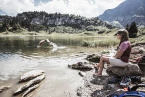
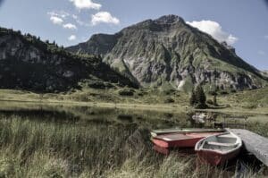
The starting point is the Steffisalp cable car, which takes you comfortably up the first few metres of altitude. From the mountain station, turn right towards Spitziger Stein, where the first mountain lake is hidden behind the summit cross. WOW! Blue-green reservoir with a view of the Biberkopf! Then continue towards the Hochalphütte, which is perfect for a lunch or coffee break. Past the hut we head to the second lake: the Panoramasee. The name says it all here! The turquoise-blue mountain lake glistens in front of a magnificent panorama, which is mainly characterised by the Widderstein. Of course, you could always descend again - but if you still have enough power, you should definitely continue over the Salobersattel to the Körbersee. Total panorama! Once you've arrived at the Körbersee, you've earned the homemade cake! From there you can comfortably descend to the chalets.
Duration: to the panorama lake approx. 60 minutes; from the panorama lake to the Körbersee again approx. 60 minutes.
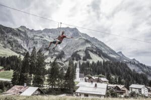
You can start this hike directly from your chalet. Go to the main road and follow the main road down until the pavement ends and a bridge begins - the road down to the right is the right one. Pass Haus Annette and follow the old road for about 15 minutes until you see a turn-off on the left towards Körbersee or Auenfeld. Follow this for about 10 minutes, then a narrower path leads off to the right in the direction of Alpe Felle. You will pass the Gletschermühle (glacier mill), which you should definitely take a look at - a relic from the Ice Age! After crossing the Fellbach stream, you will arrive at Alpe Felle in a few minutes. There you not only have a great view of the village and the surrounding mountains, but also homemade alpine products that you should definitely try! After your break, you will pass the Alpe Felle and head back downhill to the village, from where the hiking bus will take you back to Nesslegg.
Duration: approx. 60 minutes
Longer option: in this slightly longer option, you start your hike from your chalet. Follow the main road down for a few metres, then turn left onto a path that leads to a bridge over the stream. The trail then climbs a little uphill along a narrow path towards the Körbersee lake. Here you can already enjoy panoramic views, which are dominated by the village and the mountain peaks! When you reach the Körbersee, the Berghotel Körbersee is perfect for a delicious break. 😉 Past the Körbersee lake, the trail continues to the Kalbelesee lake and Hochtannbergpass. At the end of the Kalbelesee you can already see the Simmel with the enthroned World Peace Cross! Arrived at the main road, we follow the road to the Hotel Adler, where the ascent to the Simmel is on the right hand side. Once you have reached the Simmel, enjoy the view of the lake and the mountains from the World Peace Cross!
Duration: approx. 130 minutes
Shorter option: start at Hotel Adler, where the ascent to Simmel is on your right. The gravel path leads you past a chapel to the World Peace Cross - view guaranteed.
Duration: approx. 20 minutes
You start this "house circuit" directly from your chalet. There you turn left and come to a large car park. At the end of the car park, a narrow path leads off and you cross the Litzetobel. Then turn right and take the ascent in the direction of Schlössle. At an alpine hut you will come to a fork, where you will have to overcome the short climb to the top one last time, where the reward awaits you: a 360 degree view over the whole of Schröcken and the mountains that surround our village. The trail then continues flat and partly downhill to the Sulzalpe, which is followed by the descent to the Wald parcel. We then keep left in the direction of the Schmitte parcel. Once there, follow the asphalt road upwards until you arrive back at your starting point!
Duration: approx. 75 minutes
The starting point is the mountain station of the Steffisalp cable car, with which you can quickly and comfortably cover a few metres in altitude. At the mountain station on the left, the trail leads in the direction of Bürstegg - here you can already enjoy the far-reaching view of mountain peaks such as the imposing Biberkopf or the view into the village. The trail then leads to Bürstegg, the former highest Walser settlement in Voralberg. After you have marvelled at the old settlement, you continue down the valley with a view. The trail leads you directly to the Bürstegg bus stop, from where the hiking bus takes you back.
Duration: approx. 130 minutes
The starting point here is also the mountain station of the Steffisalp cable car, from which a path leads off to the right in the direction of Spitziger Stein. You should definitely go behind the Spitziger Stein with its summit cross, because a blue-green reservoir with a view of the Biberkopf is hidden there! Then head to the Hochalphütte, which invites you to take a culinary break. 😉 Pass the hut and head uphill to the panorama lake - WOOW! Finished with amazement, you go to the Saloberkopf, continue over the Salobersattel, where you then keep left towards the Auenfelderhütte (here you get the most delicious, homemade dumplings!!). Pass the Auenfelderhütte to the Untere Auenfeldalpe and then continue left to the former Walser settlement Bürstegg. The path leads slightly uphill back to the Steffisalpe mountain station. On this hike you won't be able to stop marvelling at the panoramic views!
Duration: approx. 250 minutes
For an amazing view, one thing is particularly suitable: passes! How good that we have three of them! The bus or the car will take you to Gehren in about 15 minutes, where you hike along the municipal path to the last house. Once there, you start off in the direction of Gehrnerberg to the Koblat Pass. First pass completed! With a view you continue to the second pass: the Gemstelpass. Don't forget to look around! Then it's on to the Widdersteinhütte, where you really deserve a snack (with a good view!). From there you can descend directly or choose the descent over the third pass: the Hochalp Pass. Pass the Hochalpsee and return to the Hochtannbergpass. From there, the bus will take you comfortably back to your chalet.
Duration: approx. 300 minutes
Do you fancy a mountain panorama? Then take a look at our packages - for your mountain holiday with a view with us in the Aadla Chalets.
Our smaller chalets are perfect for couples or small families - the large chalets offer friends or the extended family plenty of space to enjoy! The private wellness area is equipped, among other things, with a hot tub that can also be filled with cold fresh water for refreshment. on your own terrace provides - whether in summer temperatures or after the sauna.

